Santa Barbara Wine Country Map: How the Region Fits
The wineries sit in two very different places: a walkable downtown district and a spread of inland valleys about forty minutes away. Here is how the whole region lays out.
Short answer
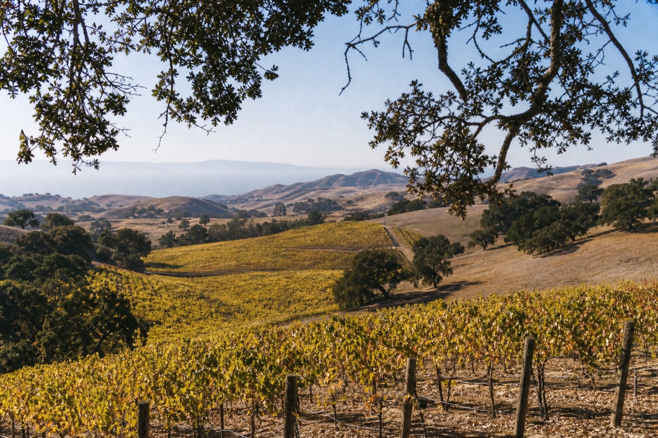
Santa Barbara wine country splits into two parts. A walkable urban district near the city waterfront holds around twenty tasting rooms, and the inland Santa Ynez Valley, roughly forty minutes over the San Marcos Pass, holds the bulk of the estates across seven federal appellations that run from cool coastal Pinot country to warm inland Cabernet ground.
Most first-time visitors picture Santa Barbara wine country as one place, and the map corrects them fast. The vineyards are not in the city. More than 250 wineries sit across Santa Barbara County, and the great majority of the growing happens on the inland side of a coastal mountain range, in valleys you reach by climbing a pass. The city itself keeps a compact cluster of tasting rooms near the water, but the fruit ripens forty minutes away, in country most people have not looked at on a map before they arrive.
That geography is the single most useful thing to understand before you plan a day. It decides how far you travel, whether you can walk between rooms or need a driver, and what ends up in your glass, because the region spans one of the deepest stacks of federal wine appellations in California. This guide lays the whole thing out in plain terms: the two zones, the seven appellations, the towns, the drive times, and the cool-to-warm gradient that explains why one county grows both delicate Pinot Noir and muscular Cabernet.
What does a map of Santa Barbara wine country actually show?
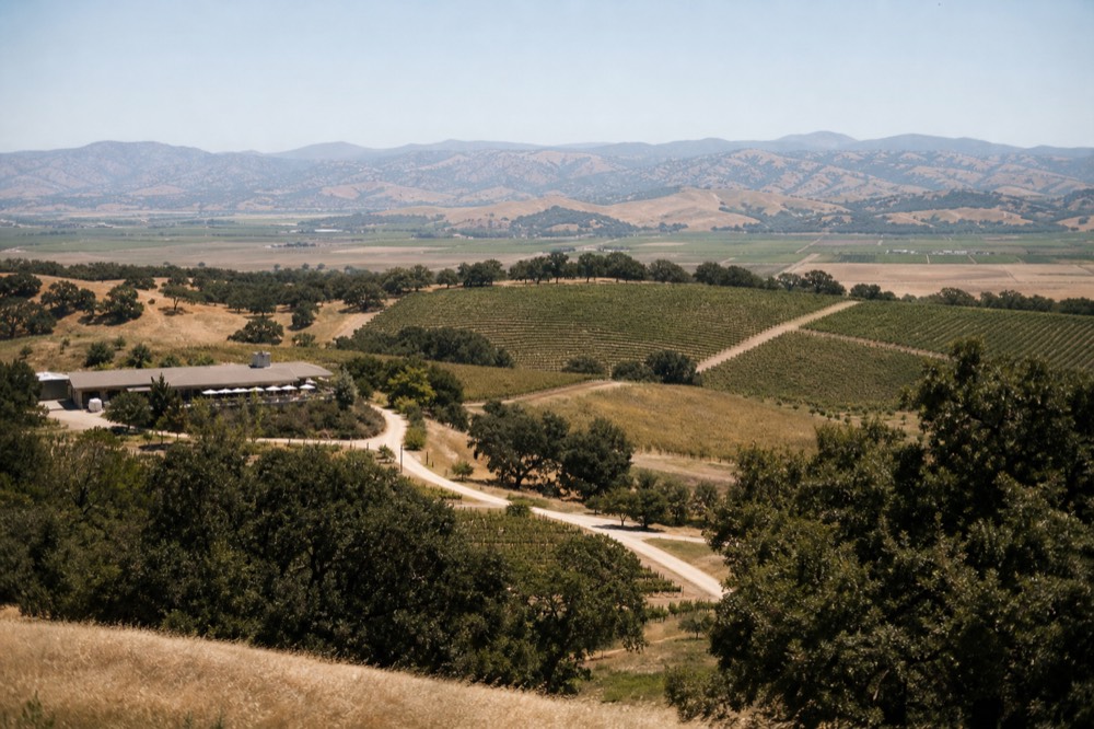
A map of Santa Barbara wine country shows two separate zones. One is the walkable urban tasting district near the city waterfront, holding around twenty rooms. The other is the inland Santa Ynez Valley, about forty minutes over the San Marcos Pass, where most of the estates and small towns sit. The two are close on paper but feel like different worlds.
Start with the split, because everything else hangs off it. The city zone is a short, dense grid of tasting rooms you can cross on foot, a few minutes from the beach and the train station. The valley zone is a spread of towns and ranch estates across open inland country, where the wineries are scattered rather than lined up and the distances between them are real. One is a stroll. The other is a drive.
Neither is more legitimate than the other. Both count as Santa Barbara wine country, and both pour Santa Barbara County wine. The difference is logistics and mood. The downtown district suits an afternoon on foot with no car involved. The valley suits a full day with someone else driving, because the good estates are miles apart and the road up is a mountain pass. The table below sets the two zones side by side so you can see which one matches the day you have in mind.
| Zone | Where it is | How you get around | Best for |
|---|---|---|---|
| Urban wine district | City side, near the waterfront and Amtrak | On foot, no car | A relaxed afternoon without leaving town |
| Santa Ynez Valley | About 40 minutes inland, over the pass | A guided day or a designated driver | A full tasting day among the estates |
If you only have a few hours and no wheels, the urban side answers the whole question by itself, and our look at the walkable downtown tasting trail in the walkable downtown tasting trail covers it room by room. If you want the vineyards and the views, the valley is the target, and the rest of this map is mostly about reading it well.
How are Santa Barbara County's seven wine appellations laid out?
Santa Barbara County holds seven federal wine appellations, one of California's deepest stacks. They run from Santa Maria Valley, established in 1981, through Santa Ynez Valley, Sta. Rita Hills, Happy Canyon, Ballard Canyon and Los Olivos District, to Alisos Canyon, the newest, added in 2020. Most cluster in and around the inland Santa Ynez Valley.
An appellation, or AVA, is a legally drawn growing region defined by climate and geography rather than politics. Santa Barbara has an unusually rich set of them for its size, and reading the map means knowing roughly where each one sits. The oldest, Santa Maria Valley, was one of the earliest appellations in the whole country, established the same year the federal system got going in earnest. The broad Santa Ynez Valley came two years later and now contains several smaller, more specific appellations nested inside it.
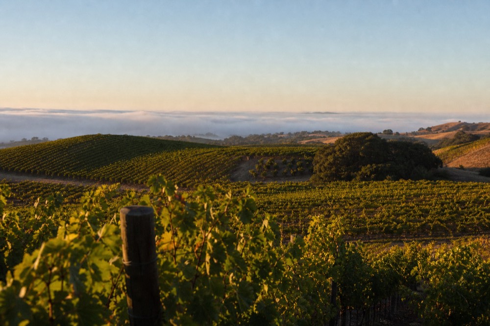
Those nested regions are where the map gets interesting, because they carve one valley into distinct characters. Sta. Rita Hills occupies the cool, fog-swept western end. Ballard Canyon sits in the warmer middle. Happy Canyon runs hot at the eastern edge. Los Olivos District wraps the walkable town at the center. The table below lists all seven with the year each was established and where it falls on the map, drawn from the seven federal appellations on record with the national tax and trade bureau.
| Appellation | Established | Where on the map | Character |
|---|---|---|---|
| Santa Maria Valley | 1981 | Far north of the county | Cool, one of America's earliest AVAs |
| Santa Ynez Valley | 1983 | The broad inland valley | Large parent region, diverse |
| Sta. Rita Hills | 2001 | Cool western end | Fog-cooled, coastal |
| Happy Canyon of Santa Barbara | 2009 | Hot eastern edge | Warmest, driest |
| Ballard Canyon | 2013 | Warm middle | Sheltered, Rhône country |
| Los Olivos District | 2016 | Around the central town | Walkable heart, diverse |
| Alisos Canyon | 2020 | North valley | The county's newest appellation |
You do not need to memorize all seven to plan a day. Most visitors taste across two or three of them without tracking the boundaries, because a good route naturally crosses the gradient. But knowing they exist explains why a single valley can pour such different wines, and it is the reason a tasting day here feels more varied than the county's size suggests. For a fuller breakdown of how the county divides, our overview of how the county's wineries split by region walks each appellation in more detail, and the cool western end gets its own treatment in our guide to the cool-climate Pinot country of the Sta. Rita Hills.
Where does the cool-to-warm gradient run across the map?
The gradient runs west to east, from cold coast to hot inland. Santa Barbara's mountains run east to west, unusual on the West Coast, so the valleys open straight to the Pacific and funnel cool fog inland. That leaves the western appellations cold and Burgundian and the eastern ones hot enough for Bordeaux grapes, all within one county.
This is the piece of the map that rewards a little attention, because it is genuinely unusual. Along most of the California coast the mountain ranges run north to south, which walls the interior off from the ocean. Here they run the other way, east to west, so the valleys act like open funnels. Marine air and fog pour straight inland off the Pacific and cool the western ground hard, then lose their grip mile by mile as they move east. The result is a temperature gradient you can practically taste as you drive across the valley.
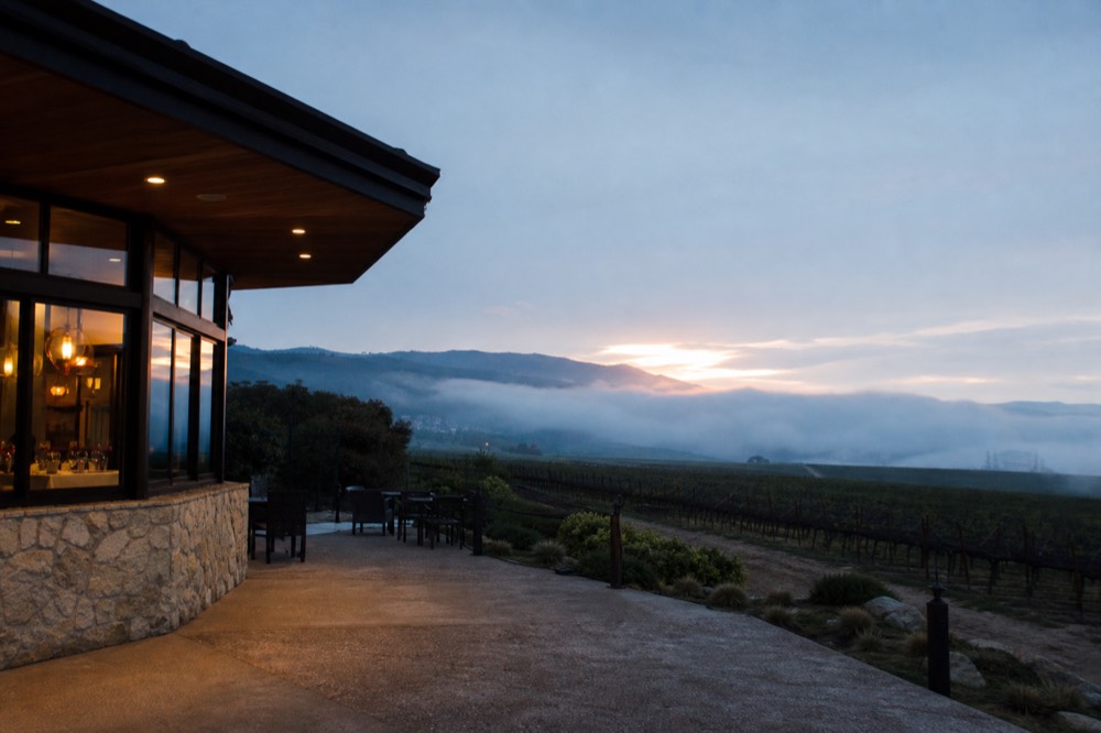
That gradient is why the varietal map lines up so neatly with geography. The cold western end grows the grapes that need a long, cool season: Pinot Noir and Chardonnay, the Burgundian pair. Move east into the sheltered middle and it warms enough for Syrah and the other Rhône varieties. Keep going to the hot eastern edge and you reach Bordeaux country, where Cabernet Sauvignon and Sauvignon Blanc ripen fully. One county, one afternoon, and a full sweep from delicate to muscular. The table below maps the grapes to the ground.
| Appellation | Climate | Signature grapes | Style |
|---|---|---|---|
| Sta. Rita Hills | Coldest, fog-cooled | Pinot Noir, Chardonnay | Bright, Burgundian |
| Santa Maria Valley | Cool | Pinot Noir, Chardonnay, Syrah | Elegant, acid-driven |
| Ballard Canyon | Warm middle | Syrah, Rhône reds | Deep, savory |
| Happy Canyon | Warmest, driest | Cabernet Sauvignon, Sauvignon Blanc | Full, structured |
| Los Olivos District | Mixed | Rhône and Bordeaux blends | Varied, approachable |
If you already know which style you love, the map hands you a shortcut: point yourself at the appellation that grows it and let a tour thread the rest. A Pinot devotee heads west; a Cabernet drinker heads east. For the wines the region is most celebrated for, our post on what this valley is known for digs into why its Pinot Noir in particular earns its reputation. The guided day that pairs best with an east-to-west sweep is the firm-price valley tour that runs a longer route across several estates.
Which towns anchor the valley map?
The valley map is anchored by a handful of small towns: Solvang, Los Olivos, Santa Ynez, Ballard, Los Alamos and Buellton, plus the Lompoc Wine Ghetto out west. Los Olivos and Solvang are the most walkable, with tasting rooms you can cross on foot. The estates between the towns are dispersed and not walkable, which is where a driver earns its keep.
Towns are how you actually navigate the valley, because the appellations are invisible on the ground while the towns have signs, parking and clusters of rooms. Los Olivos is the walkable heart, a compact grid where you can stroll between a dozen tasting rooms without moving your car. Solvang mixes its Danish-village streets with a growing set of wine rooms and works well as a base, with beds and restaurants close by. Santa Ynez and Ballard are smaller and more rural. Los Alamos is a short, characterful strip up the valley, and Buellton is the roadside town the film Sideways made famous.
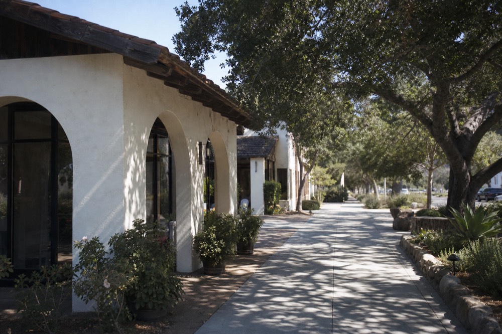
Out at the western edge, the Lompoc Wine Ghetto is the map's odd one out: an industrial park rather than a pretty street, but home to a cluster of serious small producers working close to the cool Sta. Rita Hills fruit. It rewards the curious more than the casual. The table below sorts the anchor towns by where they fall and whether you can wander them on foot.
| Town or cluster | Where on the map | On foot? | Known for |
|---|---|---|---|
| Los Olivos | Central valley | Yes, walkable grid | The densest walkable tasting scene |
| Solvang | Central valley | Yes, walkable | Danish streets, growing wine rooms, a good base |
| Santa Ynez | Central valley | Partly | Ranch character, a few rooms |
| Los Alamos | North valley | Yes, small strip | Low-key, characterful main street |
| Buellton | West-central, on Highway 101 | Partly | Sideways history, roadhouse dining |
| Lompoc Wine Ghetto | Far west | Yes, within the park | Serious small producers near the coast |
For most visitors the choice comes down to Los Olivos for the easiest strolling and Solvang for the best base, and our guides to the walkable rooms of Los Olivos and tasting your way around Solvang go town by town. The e-bike day below is the one that lets you cover a stretch of vineyard country between towns under your own power, which is a different way to read this part of the map.
Reading the map is one thing, and booking a day off it is another. For most first visits the small-group picnic day is the most-booked way to turn all this orientation into a real afternoon among the vines, with the towns, the reservations and the pass handled for you.
How far apart are the pieces of the map?
The urban district is a walk from the waterfront with no drive at all. The valley towns sit about forty minutes inland: Santa Barbara city to Los Olivos is roughly 35 miles and 45 to 50 minutes over the San Marcos Pass, and Solvang is a similar distance. Los Angeles is about two hours away, near 129 miles. Between valley towns you are looking at short 10 to 20 minute hops.
Distance is the practical heart of the map, because it decides how much of your day goes to moving rather than tasting. The good news is that the valley towns are close to one another once you are up there. The drive that eats time is the one-off climb from the coast, over the mountains, and back again. Plan for that as a bracket around your day rather than a running cost, and the valley itself feels compact.
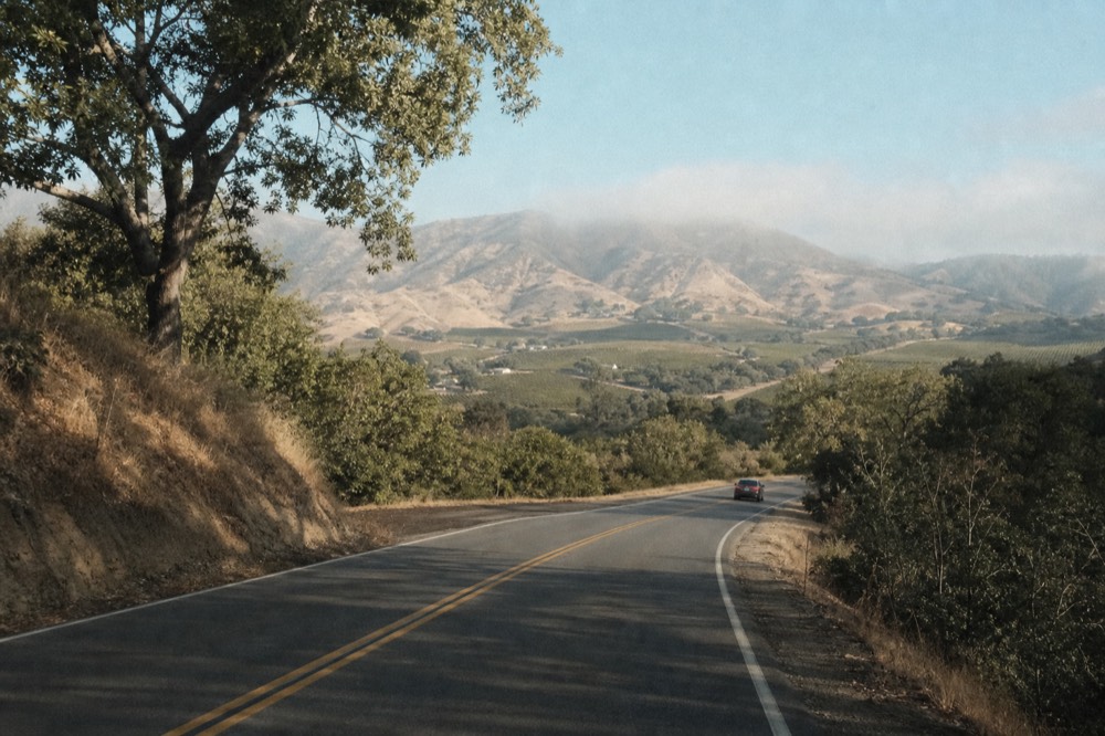
The table below sets out the distances that matter, from the city and from Los Angeles, so you can see the shape of the travel before you commit to a plan. Treat the figures as approximate, because traffic on the pass and the freeway shifts them, but the ranges are stable enough to plan around.
| From | To | Rough distance | Rough time |
|---|---|---|---|
| Santa Barbara city | Los Olivos | About 35 miles | 45 to 50 minutes |
| Santa Barbara city | Solvang | About 34 miles | 45 to 50 minutes |
| Santa Barbara city | Urban wine district | In town | A short walk |
| Los Angeles | Santa Ynez Valley | About 129 miles | Around 2 hours |
| Solvang | Los Olivos | A few miles | 10 to 15 minutes |
The distances are also the case for handing over the driving, which we will come to, and they explain why so many tours pick up in the city and fold the pass into the day. If distance is the thing you are trying to solve, our blog on how far the wineries sit from the city breaks the numbers down origin by origin, and the transport routes get their own guide in reaching the valley from the coast.
How do you read the map to plan a tasting day?
Read the map by picking one zone per outing. An afternoon on foot means the urban district. A full day among the vines means the valley, ideally with a driver, because the estates are dispersed and California's legal limit is 0.08 percent blood alcohol. Choose your appellation by the wine you love, base yourself in a walkable town, and let a guided day link the rooms that need reservations.
The most common planning mistake is trying to do both zones in one day, which turns a relaxed trip into a commute. The map plans better as two separate outings, or two separate days if you have them. Give the urban district an afternoon of easy strolling. Give the valley a whole day, because once you have climbed the pass you want time to make the drive worth it.
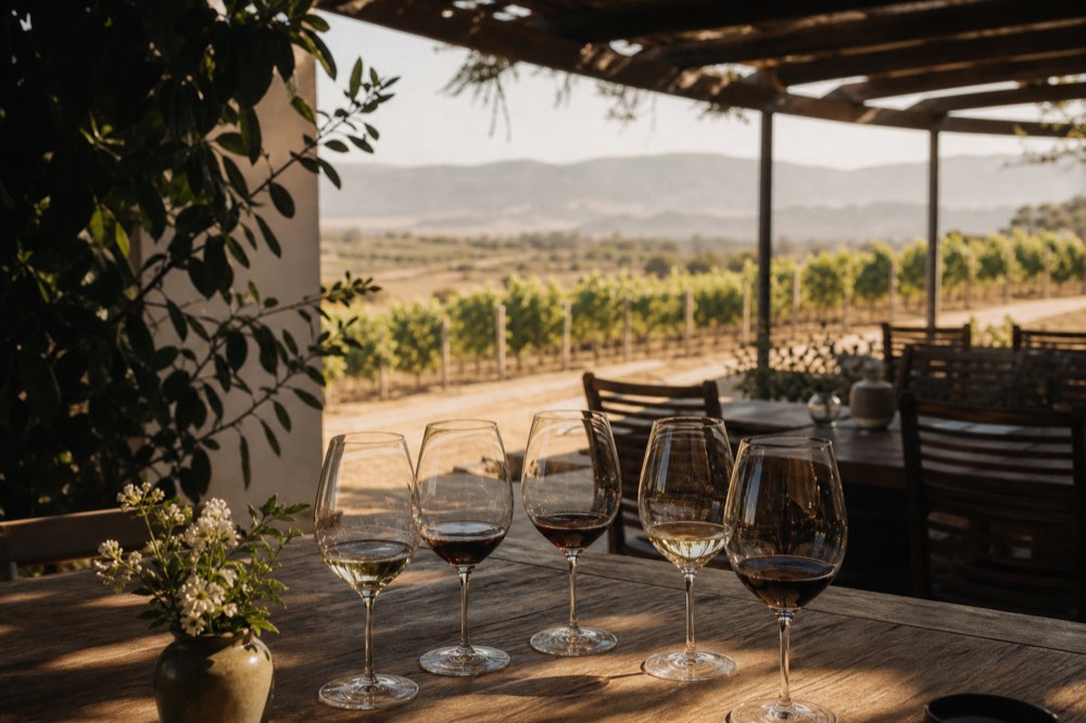
Inside the valley, the driver question is the one the map keeps raising. A tasting flight is four to six pours across three or four stops, and it adds up faster than people expect. California sets the standard driving limit at 0.08 percent under Vehicle Code section 23152, confirmed against California's 0.08 percent legal limit. The estates are scattered across ranch roads and many now want a reservation, so a guided day quietly solves three problems at once: the driving, the booking, and the pass. This is how we think about the map at Santa Barbara Wine Tours, matching you to the real day that reads the region for you rather than leaving you to decode it at the wheel. The most-booked of those is the small-group picnic day, and you can check the dates and what it covers on the operator's live listing. The table below turns the map into a simple planning grid by trip type.
| If you want | Go here | Get around by | Plan for |
|---|---|---|---|
| A car-free afternoon | The urban district | On foot | A few walk-in rooms near the water |
| Cool-climate Pinot and Chardonnay | The western end | A guided day | Appointment-only estates |
| Bold reds and Cabernet | The eastern edge | A guided day | A warmer, drier drive |
| An easy walkable base | Los Olivos or Solvang | On foot in town, driver between | Beds, food, strolling rooms |
| A full varied sweep | Across the valley | A tour that links appellations | A whole day, driver handled |
For most first-timers the top-rated small-group picnic day is the cleanest way to read the map without planning it, visiting three wineries with lunch packed along and the reservations arranged before you arrive.
When is the best time to be on the map?
September through November is the classic window, with warm 70 to 80 degree days, cool evenings and harvest energy in the tasting rooms. Summer draws the biggest crowds, winter is quietest and cheapest, and spring brings green hills with a chance of coastal fog. Tours run year-round, so the calendar is about atmosphere and price rather than whether the region is open.
The map does not change with the seasons, but the experience of moving across it does. Harvest and crush stretch from late August into October, and that is when the valley feels most alive, with fruit coming in and winemakers around the rooms. The weather in those fall months tends to be the most settled of the year, warm inland and mild on the coast, which makes the drive over the pass a pleasure rather than a chore.
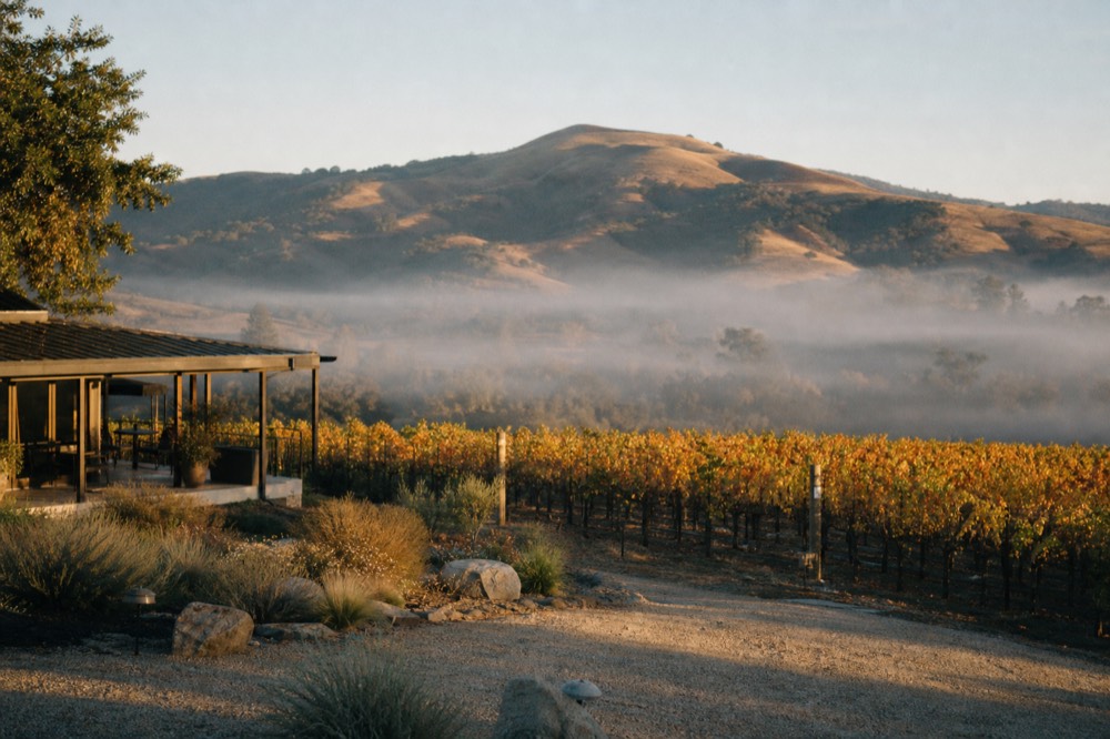
Summer is the peak, with the longest days and the busiest rooms, so book ahead. The coast can sit under a morning marine layer that locals call May Gray and June Gloom, though the inland valley usually burns off warmer and drier than the shore, one more consequence of that east-to-west geography. Winter is the quiet, green, wallet-friendly season. The table below sketches the trade-offs across the year.
| Season | Weather | Crowds | Why go then |
|---|---|---|---|
| September to November | Warm days, cool nights, harvest color | Busy on event weekends | Fall light and harvest buzz |
| June to August | Warm inland, coastal morning fog | Peak | Long days, everything open |
| December to February | Cool, green, occasional rain | Quietest | Lowest prices, unhurried rooms |
| March to May | Mild, green hills | Building | Wildflowers and shoulder-season value |
If your dates are flexible, our month-by-month look at which month suits your trip goes deeper on weather, harvest and events, and the full comparison of guided formats sits in how the valley tour days compare.
Common questions about the Santa Barbara wine country map
How many wine regions are in Santa Barbara County?
Santa Barbara County holds seven federal wine appellations: Santa Maria Valley, Santa Ynez Valley, Sta. Rita Hills, Happy Canyon of Santa Barbara, Ballard Canyon, Los Olivos District and Alisos Canyon. Most cluster in and around the inland Santa Ynez Valley, one of the deepest appellation stacks in California.
Are there wineries in Santa Barbara itself, or only inland?
Both. A walkable urban district near the city waterfront holds around twenty tasting rooms with no car needed. The bulk of the vineyards and estates sit inland in the Santa Ynez Valley, about forty minutes away over the San Marcos Pass, which is where most guided wine days head.
Why does one county grow such different wines?
The mountains run east to west rather than north to south, so the valleys open straight to the Pacific and funnel cool fog inland. That creates a west-to-east temperature gradient, from cold coastal Pinot and Chardonnay country to hot inland Cabernet ground, all within a short drive.
How far is Santa Barbara wine country from the city?
The urban tasting district is a short walk from the waterfront. The Santa Ynez Valley sits about forty minutes inland: roughly 35 miles and 45 to 50 minutes from the city to Los Olivos over Highway 154, the San Marcos Pass, with Solvang a similar distance. Los Angeles is around two hours away.
Which part of the map should a first-timer visit?
For a car-free afternoon, the walkable urban district answers it on foot. For the classic vineyard day, aim at the Santa Ynez Valley and base yourself in Los Olivos or Solvang. Pick your appellation by the wine you love, and let a guided day link the appointment-only estates.
Reserve Your Santa Barbara Wine Day
Decide the route first, then hold the date: live availability, pickup details and the current price sit on the listing, most tours cancel free up to 24 hours out, and nothing is charged on this site.
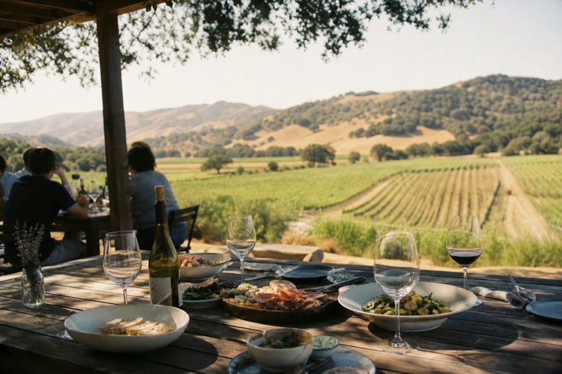
Santa Ynez Valley: 3-Winery Tour with Picnic Lunch
★ 4.9 (115 reviews) · About 5 hours
The top-rated way to turn this map into a real afternoon: three wineries across the valley, a picnic lunch and the reservations handled, with pickup from Solvang, Santa Ynez or Buellton.
Departs inside the valley rather than Santa Barbara city, so pair it with the shuttle or a from-the-city tour if you are staying on the coast without a car.
Published schedule only: final availability and price are confirmed on the listing.
Compare two alternatives inside this module
All-Inclusive Santa Ynez Valley Wine Tour
Vineyard-to-Table Wine Tour by E-Bike
Tailor the pick: where you start and how you want to move
Two questions, honest matches from the real listings. General guidance, not live inventory: confirm dates and restrictions on the listing.
Santa Ynez Valley: 3-Winery Tour with Picnic Lunch
The top-rated way to turn this map into a real afternoon: three wineries across the valley, a picnic lunch and the reservations handled, with pickup from Solvang, Santa Ynez or Buellton.